DayZ Ruegen is based on real heightmaps and geodata from the NASA. The map is placed in east germany at the federal-state Mecklenburg Vorpommern. The Isle Rügen is in the balitic sea. near the city Stralsund
All cities, towns and villages are at the exact position as the original one. All Roads at the exact positions, too. You can navigate at the map with real Maps like “google Maps” or you can buy a map in your local Stores or the internet.
Most buildings are placed at the original place or nearby the orignal one. Some ORIGINAL buildings are made as Models. There are more then 200 new Models build at this point.
More than 355 km² land are to explore and aproximate 300 km² baltic sea.
Some tourist attractions are build as models like the Ernst-Moritz-Arnd Tower or the “rasender Roland” steamtrain. Typical touristplaces placed at the map , like the “Circus” in the town Putbus or the “Koloss from Prora”.
Some facts!

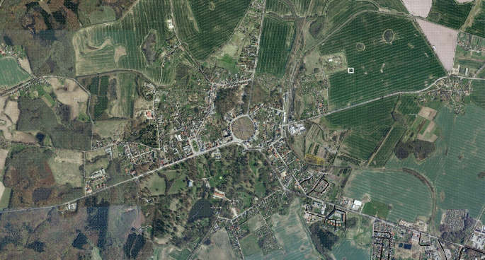
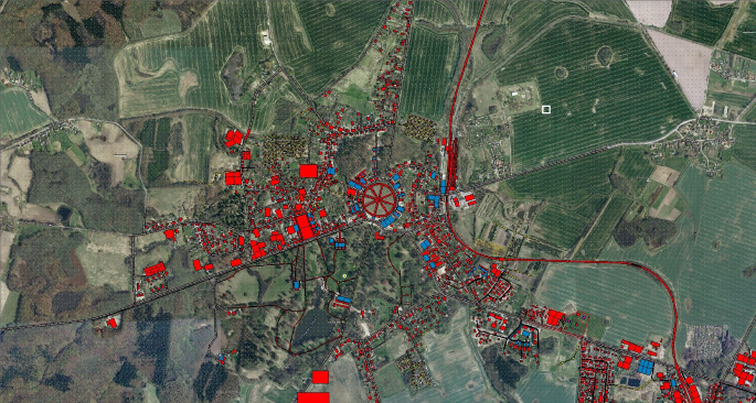
The picture above shows the original location of the town PUTBUS in google maps. You can see the tourist attraction “circus” in the middle of the picture. The next Picture shows the Visitor 3 Editor with the placed buildings and roads. 100% roadmap!
The original position of the Isle Rügen.
Thank You!
I spend a lot of time and money in this comunity project. I have started in january 2015 to build this map absolutly alone. Please donate if you want to support my work. I am appreciate all donations!

(c) 2015 by falconsan

BzVRI
Gazette